
Mobile Mapping Service for a Real Digital Twin
Infrastructure Manager

tmc Mobile Mapping Service
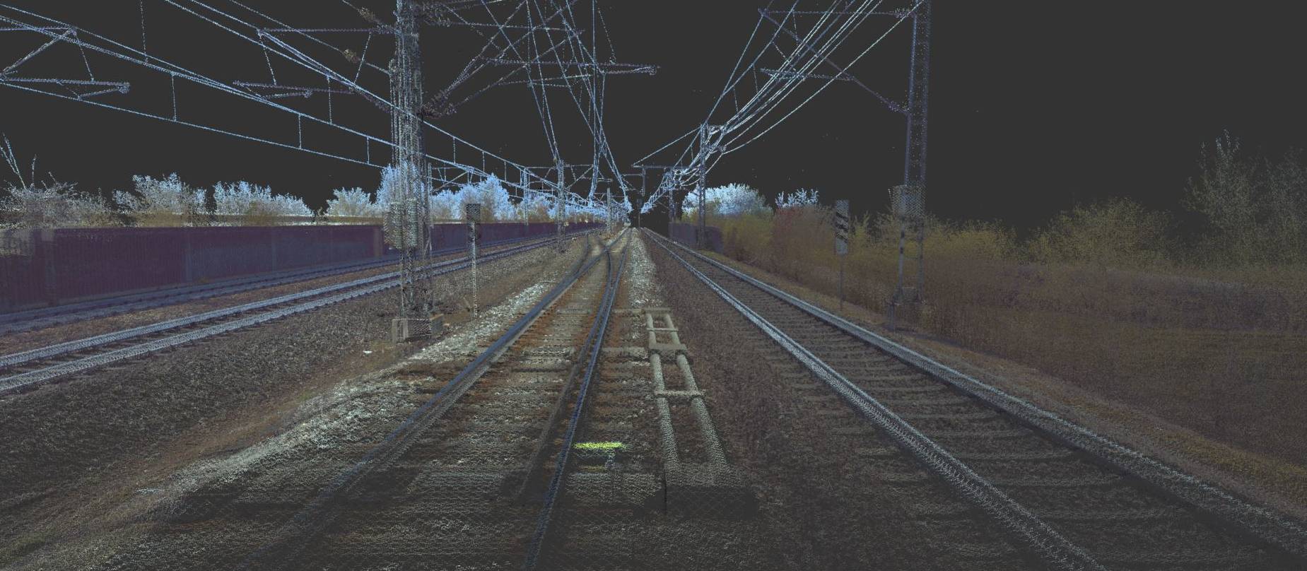
The upgraded service facilitates digitalization by providing a complete Digital Twin – or that is a highly precise point cloud.
Mobile Mapping Services are requested in the precise mapping of infrastructures, reconstruction or new construction projects, and the digitizing of networks – in our case railway networks. Traditionally, this is done by Surveyors, or Geodesists, that physically enter the track area, set up their instruments, such as tachymeters and GNSS receivers. They then record key point after key point for track planning or maintenance by walking along the tracks. Recently, tmc has introduced its advanced digital mobile mapping service. In a pilot project for a 50-km track – in collaboration with Obermeyer Group, we have taken the digital mobile mapping quality to a higher level. The upgrade makes it possible to quickly create a complete digital twin of each railway track and to get more track information with the same top-level precision. Both faster and cheaper, the mapping process just got easier. Access any part of the recorded route to perform any measurement! See how in this video.
Service Details
tmc’s upgraded Mobile Mapping service uses the latest recording systems, such as the Riegl VMX on fully equipped and calibrated measurement cars. Accuracy, safety, and high cost and time efficiency are achieved via a detailed and structured data collection process chain. To ensure top-notch precision, tmc’s diverse tool landscape and expert know-how is used to power the data processing insights, and complete the trajectory calculation, point cloud creation, photo synchronization and target mapping.
Your Benefits
- Faster Processes: allows for high-speed measurements while avoiding track closures
- Safer Track Work: avoids personnel’s physical tracks presence to take measurements
- Cheaper service
- Easy Access & 24/7 Unlimited Availability of Information to any point on route to take desired measurements
- Improves Upcoming Digitalization Processes: via more efficient feature track geometry editors for future tamping work input.
